  
Watershed Report

Central NYS With the Flow
Report for the Week of June 5 to June 11, 2023
Low flows becoming a concern for drinking water reservoirs
Collecting rainfall and snowmelt from the central state areas that run toward New York City emptying into the Atlantic Ocean at Long Island Sound
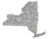
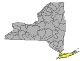
Find your location in one of the six watersheds of the central drainage basin
|
Central NY Drainage Area
|
Low Flows
|
Impaired
Water
Bodies 303d list
|
Boil Water Advisories
|
HABs
|
Hazardous Spills
|
|
Upper Hudson River
|
4
|
26
|
0
|
0
|
5
|
|
Mohawk River
|
5
|
28
|
0
|
0
|
8
|
|
Lower Hudson River
|
3
|
80
|
1
|
6
|
25
|
|
Delaware River
|
8
|
25
|
0
|
1
|
4
|
|
Housatonic River
|
0
|
0
|
0
|
0
|
0
|
|
Atlantic Ocean/LIS
|
5
|
200
|
0
|
4
|
37
|
|
Totals
|
25
|
359
|
1
|
11
|
79
|
Table updated June 12 19:00 EDT
Upper Hudson River Watershed
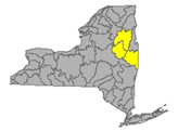
The Upper Hudson River Watershed drains the south side of the Adirondack Mountains, originating on Mt. Marcy and flowing south; the watershed management area extends to the Albany-Rensselaer County line. From the confluence of the Mohawk River, the Lower Hudson River gathers volume and carries on south to the Atlantic via Long Island Sound tidal estuary.
Major water bodies include Sacandaga River, Schroon River, Indian River, Fish Creek, Hoosic River, Batten Kill, Great Sacandaga Lake, Indian Lake, Schroon Lake, Saratoga Lake taking the runoff from parts of Essex, Hamilton, Saratoga, Washington, Rensselaer and Warren Counties
- Upper Hudson River drains an area of 8288 sq miles from headwaters to Albany;
- at Newcomb in Essex County the normal flow is around 230 cfs and just over 2 ft deep (minor flood stage 12.5 ft);
- at North Creek in Warren County a normal flow is 1300 cfs and 4 ft deep (minor flood stage 10ft);
- at Hadley flow is normally less than 3000 cfs and 4 ft deep (minor flood stage 14 ft);
- at Fort Edward in Washington County, normal is around 6000 cfs and less than 20 ft deep (minor flood stage 26 ft);
- above Lock 1 near Waterford, the station measures flows normally less than 10,000 cfs and 21 ft deep (minor flood stage 34 ft).
- Hudson River 303d listed for iron, aluminum and total phenols, copper, pH, listed in 1998 for PCBs, mercury, recommended for delisting in 2022 due to flawed original analysis
- Vanderwhacker Brook Trib 2 drains an area of .35 sq miles in Essex County before entering the Boreas River system. There are no active monitors on the Boreas, which runs through Essex County, and joins the Hudson system. Vanderwhacker Brook station has not been monitored long enough to give a rating of low flow, normal, above normal etc, the flow here has been measured at less than 1 cfs and half a foot deep.
- Durgin Brook drains an area of 6.86 sq miles of Essex County before entering the Boreas River system. Flow at Boreas River is unrated, measures around 30 cfs and three and a half feet deep while the conditions are normal.
- Indian River drains an area of 132 sq miles in Hamilton County. The flow near Indian Lake is rated normal around 500 cfs and 3 ft deep.
- Schroon River drains an area of 527 sq miles in Warren County; the flow at Riverbank is not rated, registers under four feet deep when conditions in the area are normal (minor flood stage 7ft)
- Glens Falls Feeder (canal) in Washington County at Dunham Basin is monitored seasonally. Flow here is not given a rating of normal or otherwise, during the winter months it does freeze up. No readings available as of Feb 22, 23.
- Sacandaga River drains an area of 1055 sq miles in Hamilton and Saratoga Counties. Normal flow
- near Hope is around 900 cfs and under 3 feet (minor flooding occurs at 7ft);
- at Stewart’s Bridge near Hadley can be around 4000 cfs and 5 ft deep.
- Glowegee Creek drains an area of 26 sq miles in Saratoga County. The normal flow near West Milton is under 50 cfs and under 3.5 ft deep.
- Batten Kill drains an area of 396 sq miles of Washington County. The flow below Mill at Battenville is normally less than 1000 cfs and 5 ft deep (minor flood stage 12ft).
- Hoosic River originates in Massachusetts, flowing north in MA and across New York in a westerly direction before joining the upper Hudson. The Hoosic drains an area of 510 sq miles including Rensselaer County. The flow
- near Williamstown, MA is normal under 600 cfs and 6 ft deep (minor flood stage 9ft);
- at Eagle Bridge flows around 1300 cfs and 4 ft deep (minor flood stage 11 ft)
Hoosic River 303d listed in 1998 for PCBs; proposed for de-listing in 2022 for flawed original analysis
Low Flows (4) as of June 12 10:00 am EDT
Hudson River is flowing
- low at Newcomb - down again overnight - running 1.31 ft deep and 64.2 cubic feet per second
- much below normal at North Creek - down again overnight - running 2.65 ft deep and 336 cubic feet per second
- low at Hadley - down overnight to 2.06 ft deep and 763 cubic feet per second
- much below normal at Fort Edward - running 20.82 ft deep and 2140 cubic feet per second
- much below normal above Lock 1 at Waterford - down considerably overnight to 29.95 ft deep at 2990 cubic feet per second
Sacandaga River is flowing much below normal near Hope - down again overnight - running 1.72 ft deep and 161 cubic feet per second
Batten Kill is flowing much below normal below the mill at Battenville - down again overnight - running 4.4 ft deep at 234 cubic feet per second
Glowegee Creek is flowing below normal at West Milton - down overnight - running 3.03 ft deep at 8.08 cubic feet per second
Impaired Water Bodies (26)
New and existing Class 5 impaired water bodies (26), by type, County, year of listing and contaminants/concerns in regular text, with 15 of these water bodies proposed for de-listing in whole or in part – see full list under Central tab
Drinking Water Reservoirs on the Impaired List:
- Schaghticoke Reservoir (1102-0015) in Rensselaer County, listed in 2006 for PCBs, recommended for delisting in 2022 for flawed analysis
Drinking Water Advisories (0)
Spills (5)
- June 5 - unknown amount of unknown material reported spilled deliberately into Hoosick River on Indian Massacre Rd in Petersburg - Rensselaer - Hoosick River affected *
- June 5 - unknown amount of home heating oil reported spilled at a private residence on State Route 372 in Cambridge - Washington
- June 6 - unknown amount of diesel reported spilled at a commercial location on Church St in Saratoga Springs – Saratoga
- June 7 - unknown amount of refrigerant released into the air due to equipment failure on Atomic Project Rd in West Milton – Saratoga
- June 7 - unknown amount of unknown materials reported spilled into Hoosick River on River Rd in Johnsonville – Rensselaer
Mohawk River Watershed
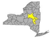
The Mohawk River originates in the western Adirondacks and the Tug Hill Plateau and flows 140 miles to the east where it joins the Hudson River. Sections of the Mohawk River also serve as the New York State Barge (Erie) Canal.
Includes Schoharie Creek, West Canada Creek, East Canada Creek; Hinkley Reservoir, Delta Reservoir, Peck Lake, Schoharie Reservoir; joins the Hudson River below Albany, receiving runoff from parts of Schenectady, Oneida, Herkimer, Montgomery, and Albany Counties
- Mohawk River drains an area of 3450 sq miles in Oneida, Herkimer, Montgomery, Schenectady, and Albany Counties. The flow
- at Delta Dam near Rome in Oneida County, normal flow is around 240 cfs and 2.3 ft deep;
- near Utica in Herkimer County, normal flow gets to 1380 cfs and 7 ft deep (flood stage 403 ft);
- at Little Falls, normal flow is in the range 2700 cfs and 7ft deep;
- at Fonda the flow is unrated, we have noted it at 4700 cfs and 13 ft deep, this station records water temp;
- at Amsterdam in Montgomery County unrated, can be 6800 cfs and 11.74 ft deep, and there is a temp monitor here also;
- at Lock 8 near Schenectady in Schenectady County, flow is commonly 11 ft deep, temp and conductivity are measured here;
- at Freeman’s Bridge in Schenectady County flow is unrated, we see this station around 7400 when the rest of the monitors are normal, 11 ft deep (flood stage 20ft);
- at Rexford in Saratoga County an unrated flow commonly read at 11 ft deep, temp and conductance monitors here;
- at Vischer Ferry Dam flow can be see at 10 ft deep when the system is flowing at a normal rate;
- at Cohoes in Albany County normal flow is around 7300 cfs and 11.5 feet deep, measured above the confluence with the Hudson River (flood stage 20ft). (updated 03-30-23-23)
Listed 303d for aluminum, copper, low oxygen, fecal coliform, PCBs
- Oriskany Creek drains an area of 144 sq miles in Oneida County into the Mohawk River. The flow at Oriskany is unrated, 104.5% above mean at 361 cfs and 3.82 ft deep (updated 01-26-23)
- Sauquoit Creek drains an area of 59.8 sq miles of Oneida County into the Mohawk River. The flow at Whitesboro is unrated, 109.6% above mean at 137 cfs and 2.23 ft deep. (updated 01-26-23)
Sauquoit Creek 303d listed in 2002 for PCBs, proposed for delisting in 2022 for flawed original analysis
- Moyer Creek drains an area of 18.2 sq miles in Herkimer County. The flow at Frankfort is unrated, we see this around 25 cfs and 2.5 ft deep. (updated 03-30-23)
- West Canada Creek drains an area of 560 sq miles in Herkimer County into the Mohawk River. The flow
- near Wilmurt flow is unrated, 300 cfs and 3 ft deep is common;
- at Kast Bridge in Herkimer County, normal flow is under 1700 cfs and 3.5 ft deep. (updated 03-30-23)
West Canada Creek 303d list: Upper and minor tributaries (1203-008) in Herkimer County, listed in 1998, 2004 for pH
- East Canada Creek drains an area of 289 sq miles of Herkimer County into the Mohawk system. Normal flow at East Canada Creek in Herkimer is 600 cfs and 2.3 ft deep (updated 03-30-23)
- Steele Creek drains an area of 26.4 sq miles in Herkimer County into the Mohawk River. The flow at Ilion is unrated, it can be seen at around 70 cfs and 2.9 ft deep. (updated 03-30-23)
Steele Creek 303d listed in 2004 for total phosphorous; listed in 2004 for silt/sediment, proposed for delisting in 2022 for flawed original analysis
- Fulmer Creek drains an area of 21.7 sq miles of Herkimer County into the Mohawk system. The flow at Mohawk is unrated, we see this location measuring around 30 cfs and 2.4 ft deep. (updated 03-30-23)
- Otsquago Creek drains an area of 61 sq miles in Montgomery County into the Mohawk system. Normal flow at Fort Plain is in the league of 150 cfs and 1.8 ft deep. (updated 03-30-23)
- Canajoharie Creek drains an area of 59.7 sq miles in Montgomery County. The flow at Canajoharie is unrated, when all other flows are normal, we note this station around 135 cfs and 2.7 ft deep (updated 03-30-23)
- Schoharie Creek drains an area of 886 sq miles of Schoharie County flowing north to join the Mohawk River;
- near Lexington the flow is unrated, it can get to 500 cfs and 3.5 ft deep on an average day;
- at Prattsville, normal velocity is less than 900 cfs and 4.5 ft deep (flood at 12ft);
- at Gilboa, normal flow is 1300 cfs and 13 ft deep (flood stage 17 ft),
- near North Blenheim is unrated, flow can be 1500 cfs and 5.4 ft deep;
- at North Blenheim, normal flow is around 1100 cfs and 4 ft deep;
- at Breakabeen, normal is 1650 cfs and 4 ft deep (flood stage 11ft);
- at Middleburgh flow is not rated, 1200 cfs and 6.5 ft deep is not unusual;
- at Schoharie, 6.75 ft deep;
- at Esperance, 1.8 ft deep;
- at Burtonsville in Schoharie County, normal flow is less than 1600 cfs and 2 ft deep, (flood stage 6ft) (updated 03-30-23)
- Fox Creek drains an area of 99 sq miles in Schoharie County. The flow near Schoharie is unrated, 700 cfs and 3 ft deep are not out of the ordinary. (updated 03-30-23)
- Little Schoharie Creek drains an area of 18.1 sq miles of Schoharie County. The flow near Middleburgh is unrated, 100 cfs and 3 ft deep are common levels. (updated 03-30-23)
- West Kill drains an area of 27 sq miles in Greene County. The flow
- near Spruceton is unrated, 17 cfs and .85 ft deep;
- at West Kill is unrated, 130 cfs and 3.8 ft deep are common here. (updated 03-30-23)
- East Kill drains an area of 35.6 sq miles in Greene County. The flow near Jewett Center is unrated, 160 cfs and 4 ft deep is not unusual. (updated 03-30-23)
- Manor Kill drains an area of sq miles in Schoharie County. Normal flow at West Conesville near Gilboa is 200 cfs and 1.8 ft deep. (updated 03-30-23)
- Platter Kill drains an area of 10.9 sq miles in Schoharie County. Normal flow at Gilboa is 40 cfs and 2 ft deep. (updated 03-30-23)
- Mine Kill drains an area of 16.2 sq miles in Schoharie County. Normal flow near North Blenheim is 60 cfs and 2.75 ft deep. (updated 03-30-23)
- Batavia Kill drains an area of 68.6 sq miles in Greene County before joining with Schoharie system. The flow at Red Falls near Prattsville is unrated, 290 cfs and 2.8 ft deep. (updated 03-30-23)
- Cobleskill Creek drains an area of sq miles in Schoharie County heads north to join the Mohawk River. The flow at S. Grand Street, Cobleskill is unrated, we see this one at 400 cfs and 4.8 ft deep. (updated 03-30-23)
- 303d listed in 2004 for fecal coliforms.
Low Flows (5) June 12 10:00 am EDT
Mohawk River is flowing
- low below Delta Dam near Rome - running 2.08 ft deep and 176 cubic feet per second
- much below normal near Little Falls - down overnight - running 4.76 ft deep and 656 cubic feet per second
- much below normal at Cohoes - running 6.88 ft deep and 506 cubic feet per second
East Canada Creek is flowing low at East Creek - running 1.02 ft deep at 24.2 cubic feet per second
Schoharie Creek is flowing
- much below normal at Prattsville - running 2.95 ft deep and 66.5 cubic feet per second
- much below normal at Breakabeen - running 1.15 ft deep and 32.5 cubic feet per second
- much below normal at Burtonsville - down overnight - running .87 ft deep and 81.7 cubic feet per second
Mine Kill is flowing low near North Blenheim - running 1.74 ft deep and 3.17 cubic feet per second
Platter Kill is flowing much below normal at Gilboa - running 1.84 ft deep and 3.55 cubic feet per second
Impaired Water Bodies (28)
28 sites proposed in 2020-2022 Draft 303d, for details see list on this site.
Schoharie Reservoir receives rainfall and snow melt run-off from an area of 315 sq miles in Schoharie County. Schoharie Reservoir (1202-0012), lake/reservoir in Greene County, listed in 1998 for silt/sediment; recommended for de-listing in 2022 for flawed original analysis
Drinking Water Advisories (0)
HABs (0)
Spills (8)
- June 5 - unknown amount of hydraulic oil reported spilled due to equipment failure at a private residence on Hughes Rd in Amsterdam – Montgomery
- June 7 -unknown amount of raw sewage reported spilled on Route 214 in Lanesville – Greene
- June 7 - unknown amount of gasoline reported spilled at a gas station on Troy - Schenectady Rd in Colonie - Albany
- June 8 - 5 gallons of antifreeze reported spilled on the road due to equipment failure on South St in Utica – Oneida
- June 8 - 900 gallons of waste oil reported spilled at St Johns Quarry on state highway 5 in St Johnsville – Montgomery
- June 9 - unknown amount of gasoline reported spilled in Mohawk River by the boat launch on Flint Lock Rd in Waterford - Saratoga - Mohawk River affected *
- June 9 - unknown amount of unknown petroleum reported spilled at a vacant strip mall on Church St in Amsterdam – Montgomery
- June 11 - unknown amounts of gasoline reported spilled at a Cumberland Farms Gas Station on Loudon Rd in Cohoes - Albany
Lower Hudson River Watershed
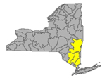
The Lower Hudson Watershed begins where the Mohawk River joins the Hudson system at the Troy Dam and extends down to Manhattan, supplying surface water to fill the drinking water reservoirs for approximately 15 million customers, including New York City. The lower end of the Hudson system, 153 miles, is technically a tidal estuary, not a river.
Includes Rondout/Wallkill Rivers, Stockport/Kinderhook Creeks, Catskill Creek, Esopus Creek, Croton River; Ashokan Reservoir, Rondout Reservoir, New Croton Reservoir, Alcove Reservoir, Cross River Reservoir, Muscoot/Upper New Croton Reservoir receiving runoff from parts of Albany, Rensselaer, Dutchess, Columbia, Ulster Counties
- Lower Hudson River drains the bottom end of a total area more than 12,600 sq miles in New York State.
- At Green Island in Albany County, the Hudson is flowing normal, 113.4% above mean at 19400 cfs and 17.57 ft deep (flood stage 21.5);
- at Albany is 1.08 ft deep (flood stage 11 ft) 1.7°C;
- at Port of Albany, flow is reporting 1.48 ft deep, 1.4°C and 291 µS/cm;
- the tidal estuary near Poughkeepsie station in Dutchess County flow is 3.06 ft deep, 1.4°C, 236 µS/cm
- at South Dock at West Point(Orange) 54 ft deep, 2.2°C with specific conductance of 236 µS/cm;
- at Piermont the flow is not rated, 1.03 ft deep (USGS flood stage 4.3 ft) ---°C and --- µS/cm (sensors are malfunctioning) (updated 01-26-23)
Lower Hudson 303d listed in 2022 for Aluminum, Copper, Iron and Total Phenols. A listing in 1998 for PCBs is suggested for delisting in 2022 due to flaws in original analysis.
- Normans Kill drains 168 sq miles of Albany County. The flow
- at Karlsfield is not rated, can be around 9.5 ft deep;
- the flow at Albany is unrated, when conditions are average this station records a flow of 360 cfs and 3.8 ft deep. (updated 03-03-23)
- Esopus Creek drains an area of 419 sq miles of Ulster County;
- below Lost Clove Rd at Big Indian in Ulster the flow is unrated, when conditions are average we see this creek at 60 cfs and 3.7 ft deep;
- at Allaben, a normal flow rate is less than 200 cfs and 3.8 ft deep;
- at Coldbrook a normal flow is 830 cfs and 5.3 ft deep (flood 11ft), temp is recorded here;
- near Lomontville is unrated, can flow at 150 cfs and 3.3 ft deep;
- at Mount Marion a normal flow is less than 1100 cfs and 15 ft deep (flood stage 20 ft). (updated 03-03-23)
Esopus Creek 303d listed in 2012 for turbidity; Esopus Creek, Upper, including minor tributaries (0007) in Ulster County, listed in 1998 for silt/sediment, considered for delisting in 2022 due to flawed original analysis.
- Stony Clove Creek drains an area of 30.9 sq miles in Ulster County before entering the Ashokan Reservoir. The flow below Ox Clove at Chichester is unrated, we do see it at at 110 cfs and 2.8 ft deep. (updated 03-03-23)
- Birch Creek drains an area of 12.5 sq miles in Ulster County and enters the Ashokan Reservoir. The flow at Big Indian is unrated, it has been recorded at 30 cfs and 3.2 ft deep. (updated 03-03-23)
- Beaver Kill drains an area of sq miles in Ulster County before joining Esopus Creek. The flow at Mount Tremper is unrated, we see it at 80 cfs and 7 ft deep. (updated 03-03-23)
- Woodland Creek drains an area of 20.6 sq miles of Ulster County. The flow
- above mouth at Phoenicia flow is unrated, around 55 cfs and 4.5 ft deep. (updated 04-18-23)
- Valatie Kill drains an area of 9.8 sq miles of Rensselaer County before joining the Hudson; normal near Nassau is around 20 cfs and 2 feet deep. (updated 04-18-23)
Valatie Kill 303d listed in 2010 for PCBs, considered for delisting in 2022 due to flaws in the original analysis.
- Bush Kill drains an area of 69.3 sq miles of Ulster County before entering the Ashokan Reservoir. The flow below Maltby Hollow Brook at West Shokan is unrated, often seen around 40 cfs and 2.7 ft deep. (updated 04-18-23)
- Hollow Tree Brook drains an area of 1.95 sq miles in Greene County, joining the Stony Clove Brook and entering Ashokan Reservoir. The flow at Lanesville is unrated, we see 7.5 cfs and 2.5 ft deep. (updated 04-18-23)
- Myrtle Brook drains an area of 1.81 sq miles in Greene County. Flow at Edgewood is unrated, this we see around 4 cfs and 4 ft deep. (updated 04-18-23)
- Warner Creek drains an area of 8.71 sq miles in Ulster County. Flow at Chichester is unrated, often measuring around 22 cfs and 2 ft deep. (updated 04-18-23)
- Kinderhook Creek drains an area of 329 sq miles in Columbia County before joining the Hudson River. Normal flow at Rossman is 400 cfs and 3.8 ft deep. (updated 04-18-23)
- Wappinger Creek drains an area of 181 sq miles of Dutchess County; normal flow at Wappinger Falls is around 350 cfs and 3.6 ft deep (flood stage 8ft) (updated 04-18-23)
- Rondout Creek drains an area of 383 sq miles in Ulster County;
- at Lowe’s Corners normal flow is around 90 cfs and 3 ft deep;
- at Rosendale normal flow is around 300 cfs and 9.6 ft deep (flood stage 18 ft)(updated 04-18-23)
- Chestnut Creek drains an area of 20.9 sq miles in Sullivan County. Normal flow at Grahamsville is around 60 cfs and 1.3 ft deep. (updated 04-18-23)
- Croton River drains an area of 378 sq miles of Westchester County into the Croton Reservoir for the New York City water supply. Normal flow at New Croton Dam near Croton-on-Hudson is 300 cfs and 2.4 ft deep. (updated 04-18-23)
Croton Reservoir 303d listed in 2018 for low dissolved oxygen and total phosphorous in excess of standard
- West Branch Croton River drains 80.4 sq miles of the Croton River basin in Westchester County. The flow
- at Richardsville, flow is unrated, around 10 cfs and 1.2 feet deep is common;
- below dam near Kent Cliffs flow is unrated, 30 cfs and 1.7 ft deep is seen during average conditions;
- near Carmel flow is unrated, can be seen around 10 cfs and under a foot deep;
- near Croton Falls flow is unrated, 75 cfs and 3.5 ft deep is a standard situation (updated 04-18-23)
- East Branch Croton River drains an area of 81 sq miles of the Croton River basin in Westchester County. The flow
- near Putnam Lake is unrated, around 40 cfs and 3.5 ft deep;
- at Brewster flow is unrated, 50 cfs and 3.2 ft deep;
- at Croton Falls normal flow is around 60 cfs and 1.5 ft deep (updated 04-18-23)
- Horse Pound Brook drains an area of 3.94 sq miles in Putnam County, east of the Hudson River, into the New Croton Reservoir. Normal flow near Lake Carmel is 3 cfs and under a foot deep (updated 04-18-23)
- Cross River drains an area of 29.9 sq miles of the Croton River basin in Westchester County.
- near Cross River is unrated, around 16 cfs and 2 ft deep,
- at Katonah flow is unrated, around 20 cfs and 1.4 ft deep. (updated 04-18-23)
- Titicus River drains an area of 23.8 sq miles of the Croton River basin in Westchester County. The flow
- at Salem Centre is unrated, 15 cfs and 2 ft deep;
- at Purdys Station flow is unrated at 16 cfs and 1.7 ft deep; (updated 04-18-23)
- Muscoot River drains an area of 19.7 sq miles of the Croton River basin in Westchester County into the Croton River and New Croton Reservoir. The flow
- below dam at Amawalk is unrated, around 20 cfs and 8.5 ft deep; flood stage is unreported
- at Baldwin Place flow is unrated, around 8.5 cfs and 4 ft deep. (updated 04-18-23)
Muscoot River 303d listed in 2018 for ammonia and low dissolved oxygen
- Wallkill River drains an area of 695 sq miles in Ulster County. The normal flow at Gardiner is 1500 cfs and 4 ft deep (flood stage 13 ft) (updated 04-18-23)
Wallkill River 303d listed in 2022 for pH, and 2018 for total phosphorous.
Low Flows (3) June 12 10:00 am EDT
Chestnut Creek is flowing much below normal near Grahamsville - running .42 ft deep and 10.9 cubic feet per second
Esopus Creek is flowing much below normal at Allaben - running 3.03 ft deep and 29.8 cubic feet per second
Rondout Creek is flowing
- much below normal at Lowes Corners - running 2.65 ft deep and 21.1 cubic feet per second
- below normal at Rosendale - running 9.02 ft deep and 146 cubic feet per second
Impaired Water Bodies (80)
80 distinct water bodies appear on the new Draft list in the Lower Hudson River Watershed. Note that each lake/reservoir or section of creek/river may have multiple impairments listed, and each impairment has its own line in the official list, but for our purposes here, we count an impaired water body once. Of the 80 listed, 8 are reservoirs; 14 sites have been put forward for one or more contaminants being delisted. See full listing at wtny.us
- Wiccopee Reservoir (0153) in Putnam County, listed in 2022 for iron in excess of standards
- Melzing Reservoir (0183) in Dutchess County, listed in 2022 for iron
- Vly Creek Reservoir (0234) in Albany County, listed in 2022 for low dissolved oxygen
- Croton Falls Reservoir minor tributaries (0001) in Putnam County
- Browns Pond Reservoir (0013) in Orange County, listed in 2018 for total phosphorous
- Beacon/Cargill Reservoir (0017) in Putnam County, listed in 2022 for dissolved oxygen, iron and pH
- Ashokan Reservoir (0004) in Ulster County, listed in 1998 for silt/sediment is now considered for delisting in 2022 due to flawed original analysis
- Basic Creek Reservoir (0001) in Albany County, listed in 2022 for low dissolved oxygen
- Watervliet Reservoir (0001) in Albany County listed in 2018 for low dissolved oxygen, listed in 2022 for iron and manganese
Drinking Water Advisories (1) confirmed ongoing as of June 12, 2023
June 9 - Schaghticoke - According to the Schaghticoke Water and Sewer Department operator, a water outage on Calhoun Drive will affect everyone from 17 Calhoun Drive to the west. The water outage is expected to be restored today. A boil water advisory has been put in place and is expected to continue through the weekend.
HABs (6 active)
June 11 - Barrett Pond - small localized bloom confirmed in Putnam County - reported by NYS Parks
June 11 - Lake Welch - small localized bloom confirmed in Rockland County - reported by NYS Parks
June 11 - Lake Tiorati - small localized bloom confirmed in Orange County - reported by NYS Parks
June 2 - Roaring Brook Lake - small localized bloom confirmed near shore off Spur Rd in Putnam County - reported by the Citizens Statewide Lake Assessment Program volunteers
May 29 Walkill River - large localized bloom confirmed off Church Hill Rd in Ulster County - reported by the public
May 31 Chodikee Lake - large localized bloom confirmed in Ulster County along the west shore midway down the shoreline- reported by the public
Spills (25)
- June 5 - 5 gallons of unknown contaminant reported spilled at a private residence on Craig St in Watervilet – Albany
- June 8 - unknown amount of unknown material reported spilled deliberately at a private residence on Saxby Ave in Averill Park – Rensselaer
- June 5 - unknown amount of diesel and kerosene reported spilled in a barn at a private residence on US Route 9 in Schroon Lake – Essex
- June 6 - 10 gallons of ethylene glycol reported spilled due to equipment failure on Riverside Ave in Rensselaer – Rensselaer
- June 5 - unknown amount of unknown material reported spilled at Cumberland Farms gas station on Route 8W in Glenmont – Albany
- June 8 - unknown amount of unknown material reported spilled in the soil and released into the air on Breck Ave in Greenport – Columbia
- June 9 - unknown amount of unknown petroleum reported spilled from Lucky Petroleum reported spilled from Lucky Petroleum on Columbia St in Hudson – Columbia
- June 8 - unknown amount of cooking grease reported spilled deliberately into the roadway on Anthony St in Copake – Columbia
- June 5 - unknown amount of home heating oil reported spilled due to equipment failure at LASKO on Route 28 in Shandaken – Ulster
- June 9 - unknown amount of home heating oil reported spilled due to equipment failure at a private residence on Pleasant Ridge Dr in West Hurley – Ulster
- June 6 - unknown amount of home heating oil reported spilled at a private residence on Oakland Ave in Walden – Orange
- June 10 - 55 gallons of dibutyl phthalate reported spilled due to human error at the YRC freight terminal on Homestead Ave in Maybrook – Orange
- June 6 - unknown amount of gasoline reported spilled from a gas station on Route 9W in Marlboro – Ulster
- June 7 - unknown amount of salt reported spilled at a Municipal Office on Stringham Rd in LaGrange – Dutchess
- June 7 - 100 gallons of wastewater reported spilled from a semi due to equipment failure on Route 52 in Hopewell Junction – Dutchess
- June 6 - unknown amount of home heating oil reported spilled on Dykeman St in Pawling – Dutchess
- June 8 - unknown amount of unknown material reported spilled at a private residence on Wilson St in Beacon – Dutchess
- June 8 - unknown amount of home heating oil reported spilled due to equipment failure at a private residence on Mountain Rd in Cornwall – Orange
- June 8 - unknown amount of hydraulic oil reported spilled on the road due to equipment failure on Old Dutch Hallow Rd in Warick – Orange
- June 5 - 100 gallons of home heating oil reported spilled due to equipment failure at a private residence on Cromwell Hull Rd in Monroe – Orange
- June 9 - unknown amount of home heating oil reported spilled due to equipment failure at a private residence on Cole Dr in Mahopac – Putnam
- June 5 - unknown amount of unknown petroleum reported spilled and petroleum odor noted on South James St in Peekskill – Westchester
- June 8 - unknown amount of home heating oil reported spilled at a private residence due to equipment failure on Amazon Rd in Mohegan Lake – Westchester
- June 6 - unknown amount of home heating oil reported spilled due to equipment failure at a private residence on Sagamore Ave in Mohegan Lake – Westchester
- June 5 - unknown amount of home heating oil reported spilled due to equipment failure at a private residence on Oak Lane in Mount Kisco – Westchester
Delaware River Watershed
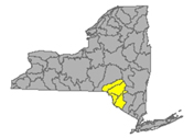
Delaware River headwaters flow down from the Catskill Mountains into Delaware Bay/Atlantic Ocean. The watershed area includes East Branch Delaware River, West Branch Delaware River, Neversink River, Mongaup River, Pepacton Reservoir, Cannonsville Reservoir and Neversink Reservoir taking the runoff from parts of Delaware, Ulster, Sullivan Counties
- East Branch Delaware River drains an area of 458 sq miles in Delaware County. The flow
- at Roxbury flow is unrated, starts out at around 30 to 60 cfs and 3.5 ft deep;
- at Margaretville, normal flow is around 800 cfs and 4 ft deep (flood stage 11ft) temp and conductance are measured here;
- at Downsville in Delaware County a normal flow in spring is 900 cfs and 4 ft deep (flood stage 9ft) there is a water temperature sensor here;
- at Harvard, normal flow is around 1000 cfs and 4.5 ft deep, (flood stage 10 ft) temp here too;
- at Fishs Eddy normal flow is around 2600 and 5.5 ft deep, (flood stage 13 ft) temperature here; (updated 04-07-23)
- West Branch Delaware River drains an area of 595 sq miles of Delaware County. The flow
- at Hobart flow is unrated, 40 cfs and 1.2 ft deep is common;
- upstream from Delhi normal flow is under 350 cfs and 3 ft deep (flood stage 8ft);
- at Walton in Delaware County, normal flow is less than 1000 cfs and 5 ft deep, (flood stage 9.5) temp and conductivity measured here;
- at Stilesville in Delaware County, the normal flow is under 2000 cfs and 8 ft deep, temp available here;
- at Hale Eddy in Delaware County, normal flow is under 3000 and 5 ft deep, (flood stage 11 ft) temp taken here.; (updated 03-30-23)
- West Brook drains an area of 22 sq miles in Delaware County. The flow at Austin Lincoln Park at Walton is unrated, 100 cfs and 4 ft deep. (updated 03-30-22)
- Town Brook drains 14.3 sq miles in Delaware County. The flow southeast of Hobart is unrated, 50 cfs and 1.8 ft (flood stage 7 ft) (updated 03-30-22)
- Dry Brook drains an area of 82.2 sq miles in Delaware County. The flow at Arkville is unrated, 147.25% above mean at 335 cfs and 2.84 ft deep. (flood stage 10.5 ft) (updated 01-26-23)
- Trout Creek drains an area of 20.2 sq miles in Delaware County direct to the Delaware River. The flow at Trout Creek is normal, 104.9% above mean, 50.1 cfs and 3.63 ft deep (flood stage 6.3 ft). (updated 01-26-23)
- Little Delaware River drains an area of 49.8 sq miles in Delaware County into the Delaware River. The flow near Delhi is normal, 114.6% above mean at 143 cfs and 3.14 ft deep. (updated 01-26-23)
- Platte Kill drains an area of 34.9 sq miles in Delaware County. The flow at Dunraven is normal, 118.4% above mean at 90.3 cfs and 3.48 ft deep (flood stage 7ft) (updated 01-26-23)
- Beaver Kill drains an area of 241 sq miles in Delaware County. The flow at Cooks Falls is above normal, 130.7% above mean at 882 cfs and 3.57 ft deep, (flood stage 10 ft) 2.2°C. (updated 01-26-23)
- Tremper Kill drains an area of 33 sq miles of Delaware County; the flow near Andes is above normal, 150.5% above mean at 121 cfs and 3.27 ft deep, (flood stage 6.8 ft) 2.5°C and 82 µS/cm (updated 01-26-23)
- Mill Brook drains an area of 25.2 sq miles in Delaware County. The flow at Dunraven is above normal, 137.7% above mean at 101 cfs and 3.62 ft deep, 2.6°and 32 µS/cm (updated 01-26-23)
- Neversink River drains an area of 93 sq miles in Ulster, Orange, and Sullivan Counties. Neversink River
- near Claryville in Sullivan County, normal flow is less than 250 cfs and 6.5 ft deep, temp and conductance here;
- at Neversink, normal appears around the 200 cfs and 3.5 ft deep, this station also measures water temp and conductance;
- at Bridgeville flow is unrated, we see this at 500 cfs and 5 ft deep (flood stage 13 ft), temp and conductance provide some indication of water quality here;
- at Godeffroy in Orange County normal flow is under 1000 cfs and 4.5 ft deep (flood stage 10ft), temp and conductance are recorded here. (updated 03-30-23)
- West Branch Neversink River drains an area of 33.8 sq miles in Sullivan County.
- At Winnisook Lake near Frost Valley headwaters, the flow is unrated, a slow flow of 3 cfs and 1.4 ft deep is common, temp and conductance also monitored here;
- at Claryville, normal flow is 100 cfs and 6 ft deep, temp and conductance are available here when the sensors are working (updated 03-30-23)
- East Branch Neversink River drains an area of 22.9 sq miles in Ulster County. The flow
- northeast of Denning flow is not rated, this system starts out around 40 cfs and 1.5 ft deep, we can see the water temp and conductance here;
- near Claryville, normal flow is under 100 cfs and 5 ft deep, temp and conductance is available here; (updated 03-30-23)
- Delaware River drains an area of 1820 sq miles of Delaware County and across the state line to empty into. The flow
- at Lordville flow is unrated, 5000 cfs and 7.8 ft deep are common measurements here, (flood stage 20 ft) temp and conductance sensors at this location;
- at Callicoon, normal flow is 4000 cfs and 4 ft deep, (flood stage 12 ft) temp and conductance sensors at this location;
- near Barryville a normal flow is 5000 cfs and 5 ft deep (flood stage 17ft) temp is recorded here;
- at Port Jervis, normal flow for spring season is 9000 cfs and 5 ft deep; (flood stage 18 ft) temp and conductance sensors at this location. (updated 03-30-23)
- Callicoon Creek drains an area of 110 sq miles in Sullivan County. The flow at Callicoon is regularly around 350 cfs and 2.2 ft deep (flood stage 7ft) with a temp sensor here (updated 03-30-23)
- Mongaup River drains an area of 200 sq miles in Sullivan County. The flow
- near Mongaup Valley is unrated, we see this at around 300 cfs and 4 ft deep (flood stage 14ft);
- near Mongaup normal flow is around 700 cfs and 3.5 ft deep, temp and conductance are recorded here (updated 03-30-23)
Low Flows (8) as of June 12 10:00 am EDT
Little Delaware River is flowing much below normal near Delhi - running 1.96 ft deep and 12.9 cubic feet per second
East Branch Delaware River is flowing
- low at Margaretville - down overnight - running 2.41 ft deep and 58.4 cubic feet per second
- much below normal at Fishs Eddy - running 4.12 ft deep and 288 cubic feet per second
West Branch Delaware River is flowing low upstream from Delhi - running 2.16 ft deep and 44 cubic feet per second
West Branch Neversink River is flowing low at Claryville - up overnight - running 5.67 ft deep and 17 cubic feet per second
Neversink River is flowing low near Claryville - running 6.28 ft deep and 45 cubic feet per second
Tremper Kill is flowing much below normal near Andes - running 2.74 ft deep and 9.98 cubic feet per second
Platte Kill is flowing much below normal at Dunraven - running 2.88 ft deep and 12 cubic feet per second
Mill Brook is flowing much below normal near Dunraven - 2.76 ft deep and 9.61 cubic feet per second
Impaired Water Bodies (25)
25 Water bodies appear on the latest Draft 303(d) list for Delaware River watershed in 2022, with 2 suggestions for delisting, in whole or in part.
For more details, check out the posted list under the Delaware tab.
Boil Water Advisories (0)
HABS (1 active)
May 31 Toronto Reservoir - large localized bloom confirmed off the east shore in Sullivan County - reported by the public
Spills (4)
- June 7 - unknown amount of home heating oil reported spilled at a private residence due to equipment failure on County route 95 in Freemont Center – Sullivan
- June 11 - unknown amounts of raw sewage reported spilled on Andrea Court in Narrowsburg – Sullivan
- June 9 - unknown amount of home heating oil reported spilled due to equipment failure at a private residence on St Pauls Place in Liberty – Sullivan
- June 7 - unknown amount of motor oil reported spilled on the roadway from a traffic accident on Route 52 in Cochecton - Sullivan
Housatonic River Watershed
A small portion of the headwaters of the Housatonic lie in eastern New York State. These waters drain the Taconic and Berkshire Mountains before joining the Housatonic and eventually emptying into Long Island Sound. Includes Tenmile River, Green River, Indian Lake, Swift/Crane Ponds receiving the runoff from parts of Dutchess and Columbia Counties
- Housatonic River drains an area of 282 sq miles in Dutchess County. The river itself is not located in New York state, but it does receive run-off from Dutchess County; near Great Barrington, MA the normal spring flows are around 1500 cfs and 4 ft deep; (04-07-23)
- Green River drains an area of 51 sq miles of Dutchess County. The flow
- near Williamstown, MA normal flow is around 200 cfs and 3 ft deep;
- at Great Barrington normal flow is 150 cfs and 1.5 ft deep. (updated 04-07-23)
Low Flows (0)
Impaired Water Bodies (0)
Drinking Water Advisories (0)
Hazardous Spills (0)
- No hazardous spills reported for the period of June 5th – 11th 2023
Atlantic Ocean/Long Island Sound Watershed
The Atlantic Ocean/Long Island Sound Watershed drains most of the New York City Metropolitan Area and all of Long Island. The drainage area includes all marine waters in New York Harbor, Long Island Sound, Block Island Sound, and along the South Shore of Long Island, and the fresh waters that drain into them.
Includes 1415 square miles of marine estuary waters, the Bronx River, Mamaroneck River, Mianus River, Peconic River, Kensico Reservoir, Lake Ronkonkoma, receiving runoff from parts of Westchester, Richmond, Bronx, Queens, Kings, Suffolk, Nassau and New York Counties.
- Bronx River drains an area of 38.4 sq miles of Bronx County. The flow at NY Botanical Garden is unrated, around 200 cfs and 1.3 ft deep is typical (flood stage 3ft) temp and conductance are measured here (updated 04-07-23)
- Valley Stream drains 3.77 sq miles in Nassau County. The flow at Valley Stream has been monitored for 65 years. Normal flow is around 3 cfs and 1ft deep. (updated 04-07-23)
- East Meadow Brook drains an area of 28.7 sq miles of Nassau County. Normal flow at Freeport is around 5 or 6 cfs and under a foot deep (updated 04-07-23)
- Massapequa Creek drains an area of 38.6 sq miles in Nassau County. Normal flow at Massapequa is 3 cfs and under a foot deep. (updated 04-07-23)
- Sampawams Creek drains an area of 22.7 sq miles in Suffolk County. Normal flow at New Babylon is 9 cfs and under one foot deep (updated 04-07-23)
- Bellmore Creek tributary drains less than 1 sq mile in Suffolk County. Normal flow near Bellmore is 2 to 3 cfs and 1 ft deep. (04-07-23)
- Connetquot Brook drains an area of 21.9 sq miles in Suffolk County. Normal flow at Central Islip is 25 cfs and 2.5 ft deep. (updated 04-07-23)
- Swan River drains an area of 8 sq miles in Suffolk County. Normal flow at East Patchogue is around 12 to 13 cfs and .5 ft deep. (updated 04-07-23)
- Carmans River drains an area of 73 sq miles in Suffolk County. Normal flow at Yaphank is 24 cfs and 1.3 ft deep (04-07-03)
- Peconic River drains an area of 74.7 sq miles of Suffolk and Nassau Counties. The flow
- at Riverhead normal flow is around 30 cfs and .5 ft deep;
- at County Hwy 105 is not rated, tidal flow depth varies from negative to 1.5 ft deep (flood stage 4.44 ft) temp and conductance are available at this station (updated 04-07-23)
- Mill Neck Creek drains an area of 8.58 sq miles of Nassau County. The normal spring flow at Mill Neck is 8 to 10 cfs and .5 feet deep. (updated 04-07-23)
- Cold Spring Brook drains an area of 7.83 sq miles in Nassau County. The normal flow at Cold Spring Harbour is 3 to 4 cfs and .25 ft deep (updated 04-07-23)
Low Flows (5) as of June 12 10:00 am EDT
Massapequa Creek is flowing much below normal at Massapequa - running .61 ft deep and 1.26 cubic feet per second
Sampawams Creek is flowing much below normal at Babylon - running .41 ft deep and 4.43 cubic feet per second
Peconic River is flowing low at Riverhead - running .33 ft deep and 17.5 cubic feet per second
East Meadow Brook is flowing below normal at Freeport - running .27 ft deep and 3.71 cubic feet per second
Bellmore Creek Tributary is flowing much below normal at Bellmore - running 1.99 ft deep at .03 cubic feet per second
Impaired Water Bodies (200)
200 water bodies appear on the Draft 303(d) list for Atlantic Ocean/Long Island Sound watershed in 2020-2022, up from 49 sites on the 2018 list. Of the 200, 49 are proposed for delisting, in whole or in part.
For more details, check out the posted list under the Atlantic/LIS tab.
Drinking Water Advisories (0)
HABS (4 active)
- June 5, May 31 Agawam Lake – 2 widespread - lakewide blooms confirmed in Suffolk County - reported by Stony Brook University
- June 2 South Merrits Pond - small localized bloom confirmed in Suffolk County - reported by Stony Brook University<br>
- May 31 Mill Pond - Watermill - widespread - lakewide bloom confirmed in Suffolk County - reported by Stony Brook University
- May 31 Wainscott Pond - widespread - lakewide bloom confirmed in Suffolk County - reported by Stony Brook University
Spills (37)
- June 11 - unknown amounts of motor oil deliberately spilled in a residential area on East 211 St in Bronx – Bronx
- June 9 - 30 gallons of unknown material reported spilled at an intersection on the corner of Montauk Hwy in Wainscot Stone Rd – Suffolk
- June 11 - unknown amounts of unknown petroleum reported spilled between Pralls Island and Shooters Island - Arthur Kill affected *
- June 6 - 100 gallons of dielectric fluid reported spilled from a transformer West of 45th St in Manhattan - New York
- June 5 - unknown amount of diesel reported spilled due to equipment failure at a private residence on 199th St in Hollis - Queens
- June 6 - 50 gallons of jet fuel reported spilled at the airport terminal 4 in Queens - Queens
- June 6 - unknown amount of dielectric fluid reported spilled at a commercial property on 20th Ave in Queens - Queens
- June 6 - unknown amount of water run off reported at a residential area on Beach 60th St in Arverne - Queens
- June 8 - unknown amount of motor oil reported spilled deliberately at a private residence on 78th Ave in Queens - Queens
- June 9 - 873 gallons amount of dielectric fluid reported spilled due to equipment failure on 137th St in Queens - Queens
- June 9 - unknown amount of unknown petroleum reported spilled in the soil on 40th Rd in Queens - Queens
- June 9 - 10 gallons of antifreeze reported spilled due to equipment failure on Merrick Blvd in Queens - Queens
- June 10 - unknown amount of motor oil reported deliberately dumped in a parking lot on 15th Ave College Point - Queens
- June 5 - unknown amount of waste oil reported spilled at an industrial facility on Hick St in Brooklyn - Kings
- June 6 - unknown amount of unknown material reported spilled into East River near Domino Park in Brooklyn - Kings
- June 7 - unknown amount of home heating oil reported spilled from abandoned drums on 12th St in Brooklyn - Kings
- June 9 - unknown amount of gasoline reported spilled due to equipment failure at Brooklyn College in Bedford Ave in Brooklyn - Kings
- June 9 - unknown amount of waste oil reported spilled in abandoned drums on Gardner Ave in Brooklyn - Kings
- June 9 - unknown amount of waste oil reported spilled on the roadside from abandoned drums on Alabama Ave in Brooklyn - Kings
- June 9 - unknown amount of unknown petroleum reported spilled in the soil at a private residence on East 59th St in Brooklyn - Kings
- June 6 - 5 gallons of foam reported spilled on the pavement and in a storm drain due to traffic accident on Southern State Park Rd in Brentwood - Suffolk
- June 6 - unknown amount of dielectric fluid reported spilled in the soil on Plum Island in Plum Island - Suffolk
- June 6 - unknown amount of unknown material reported spilled deliberately into a dumpster on Maple Place in Amityville - Suffolk
- June 7 - unknown amount of home heating oil reported spilled at a private residence on Jamaica Ace in Wyandanch - Suffolk
- June 7 - unknown hazardous materials reported spilled deliberately from KP Organization Inc on Pond Rd in Ronkonkoma - Suffolk
- June 7 - unknown amount of diesel reported spilled due to equipment failure on Veterans Memorials Highway in Hauppauge – Suffolk
- June 8 - unknown amount of wastewater and waste oil reported spilled from abandoned drums on Boston Rd in Bronx – Bronx
- June 5 - unknown amount of home heating oil reported spilled at a private residence on Douglas St in Port Leyden - Lewis
- June 5 - unknown amount of grease reported spilled due to equipment failure on Gyroe Rd in Lowville - Lewis
- June 8 - unknown amount of motor oil reported spilled in the soil due to equipment failure on Austin Rd in Watson - Lewis
- June 5 - unknown amount of unknown materials reported spilled deliberately into a drain at a private residence on North Herman Ave in Bethpage - Nassau
- June 7 - unknown amount of gasoline reported spilled from a former auto shop on Merrick Rd in Massapequa - Nassau
- June 7 -unknown amount of home heating oil reported spilled due to equipment failure at a private residence on Locust Ave in Port Washington - Nassau
- June 8 - unknown amount of unknown material reported spilled into a back alley on Tulip Ave in Floral Park - Nassau
- June 9 - unknown amount of home heating oil reported spilled due to equipment failure at a private residence on Pine St in Baldwin - Nassau
- June 6 - unknown amount of home heating oil reported spilled due to tank test failure at a hospital on West Kingsbridge Rd in Bronx - Bronx
- June 8 - unknown amount of waste oil reported spilled from a drum run on Edson Ave in the Bronx – Bronx
Report Key
Flows
WTNY describes the stream flows in each of 17 watersheds, including direction/path of flow, listing monitoring stations in order from headwaters to outlet, indicating the normal flow volume in cubic feet per second (CFS), the gage height (flow depth) during normal conditions and the flood stages, or the gage height at which flooding will occur. Locate your “home body” (the river or stream nearest you) to see where the flow originates, how high the flow must be for minor flooding to occur. Log in to USGS Waterwatch current streamflow for real time measurements at the monitoring station nearest you and sign up there for high flow alerts.
Flow volume can change rapidly during snowmelt and rain events, check your local upstream station flow levels at the USGS WaterWatch Current Streamflow site, or sign up for high flow alerts to your mobile device. Streamflow data is subject to review as sensors at the monitoring stations do malfunction from time to time. See USGS Provisional Data Statement at the end of this report for more information.
EPA Impaired Water Bodies 303d List
The EPA requires all states update a draft list of impaired water bodies (the 303d list) every two years; providing a period for public comments, presenting the draft list to the EPA. The final 303d list is published as approved by the EPA, roughly every two years.
Impaired water bodies are defined as those with contaminants measured above threshold levels, as set by the EPA Clean Water Act, or where the desired use is impaired. The latest Draft List for New York State, covering 2020-2022 has closed for public comments, being submitted to EPA for review. (See the 2020-2022 Draft Impaired Water Bodies 303(d) List, organized by watershed area, here on this site.) The 2020-2022 Draft list includes NYS lakes, creeks, rivers and reservoirs that New York Department of Environmental Conservation has recommended for de-listing, along with water bodies requiring Total Maximum Daily Load (TMDL) plans. The TMDL plan is a type of Clean Water Plans, established by a collaboration of municipal, industrial and environmental groups in an overlay zoning district.
Hazardous Algae Blooms (HABs) Beach Alerts – monitoring is complete for the season, will resume in spring 2023
Hazardous algae blooms are reported here as they are confirmed across the state, as found on the NYS Department of Environmental Conservation NYHABs notification site.
- active blooms are reports current within two weeks, observed reported and confirmed. These are listed by water body with date and time of the report, placed in the applicable watershed, with location information (accuracy of our location description is limited by the accuracy of the location tag in the report to NY DEC).
Contact parks management for the current information on local conditions before heading out and consider using an on-site rapid test for microcystin toxin.
Drinking Water Advisories
Boil Water and Do not Consume advisories issued by drinking water facilities for various reasons, short term disruptions due to water main breaks, repairs, loss of pressure are posted here by watershed area. NYS and EPA Region 2 Drinking water facility notices are posted here.
Spills
NYS Spill Hotline: 1-800-457-7362
National Response Center: 1-800-424-8802
Reporting from the latest records uploaded to the NYS Hazardous Spill Incidents database by County each week.
- Spills of petroleum products of 40 gallons or more are listed weekly in the watershed in which they occur, citing location of the spill, the contaminant spilled (if known), the quantity (if known) and the resource affected (if known) surface water, groundwater, sewer, etc, and any amount recovered at the site.
Spills over 100 gal, very toxic chemical spills and spills that impact state waters are flagged and followed up with the spiller, the state and/or EPA authorities for more information, these are marked with asterisk.*
See NY Spills Tracker for more information on these spills as it becomes available.
Note: DEC receives upward of sixteen thousand spill reports each year; each report is investigated by qualified personnel. Report files are closed when it is determined the spill is contained and under the control of the spiller or state authorities and a clean up plan is in place or completed.
Sources
WaterToday New York aggregates information and data from New York State Department of Environmental Conservation, Department of Health, Region 2- EPA, USGS, NWS, NOAA by watershed area. The accuracy of the information contained in our reports is dependent on these sources. Provisional data statements apply, confirm data with local authorities before taking action.
|
All rights reserved 2026 - WTNY - This material may not be reproduced in whole or in part and may not be distributed,
publicly performed, proxy cached or otherwise used, except with express permission.
|
|
|
