  
WaterToday - How a story unfolds
Striking off from the North American continental divide, rain and snow wash over the landscape, picking up all manner of passenger materials for transport and delivery to one of four seas. WT follows these flows, observing and reporting as sure as the pollutant discharges of one community become the source water of the next community, and so on down the line. WT brings the water news in this context of aggregated factors and downstream impact.
WT observes and reports on some of the best water quality on the continent, and also some of the most challenging public drinking water situations.
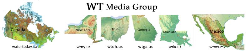
One of the shortest drainage systems on the continent supplies the best quality water. This flow originates in the Adirondacks and Catskills of New York State, taking a relatively short run to fill drinking water reservoirs for fifteen million people. Any negative impacts to NY drinking water sources are generally of local origin, whether a hazardous material spill or sewage overflow. NY state water quality is largely defined within its own borders, offering NY a great deal of influence and control over its own drinking water quality. Just .2% of New York residents receive their water from a facility tagged with significant violations of the Safe Drinking Water Act.
Those on the end of the longest water run on the continent have the least control for their source water protection. The Mississippi River and major tributaries collect contaminants from the largest drainage area on the continent. Tributaries of this massive system take runoff from the southwest corner of NY, along with all the run-off flowing south of the Ohio state divide. Western Georgia makes a contribution to this flow, with all the good, bad and ugly water factors piling up in the Gulf of Mexico at the state of Louisiana. It is in Louisiana we see the great water quality disparity, 8.5% of the population, close to 400 thousand residents are served by drinking water facilities on the EPA Serious Violators list.
Regular weekday reporting includes a consistent survey of the reported water factors detected and collected by state and federal agencies and scientists. We begin with publishing drinking water advisories from public health authorities and drinking water facilities as yellow location pins applied to our unique state maps. Next, we gather and collate monitoring data coming in from United States Geological Survey (USGS) real-time streamflow sensors, indicating high flow and floods or low flow and drought pressure, pinned to our map in black for flood, rust red for low flow. Next we layer on the hazardous spill incidents reported to state emergency response lines and confirmed toxic algae bloom reports from state sources and/or National Oceanographic and Atmospheric Administration (NOAA) satellite imaging where available. We file a weekly snapshot of these findings in our With the Flow archive report and spill logs.
The watershed layer and directional arrows show where water events collide and where impacts are most likely to be felt. The county layer shows the jurisdication responsible for response and enforcement of water quality matters. As readers find their location in the drainage basins and subwatersheds of the state, the pertinent local water news of the day pops off the map, upstream and downstream. Readers can sign up for an alert direct to mobile device by hydrologic unit code, representing the position of your water service connection within the larger drainage basin.
How a water story breaks
On Feb 3, when a train carrying a variety of hazardous materials derailed in East Palestine, Ohio, WT Media Group picked up the single line entry from Ohio spill incidents dataset, published first on our Ohio Spill report under Little Beaver Creek watershed section of the Upper Ohio Tributaries basin, simply: Feb 3 - fish kill with unknown material spill - Unity Township, Columbiana County.
The first public reporting came from media and residents within line of sight of the wreckage and smoke plume, relayed from ground zero and out to the news and social networks. As emergency evacuation orders came door-to-door, the nation learned about temperatures building up inside pressurized cars with risk of uncontrolled explosions and shrapnel. The toxic black plume spread up and outward captured in professional and amateur photos prompting the need to know what combinations of chemicals might be forming, where these would land, and what harms could result.
WT obtained open public documents from the National Transportation Safety Board identifying the contents and status of each derailed car, 50 in total. Our first incident report was a complete accounting of the contents, status, rating and serial numbers of all 50 cars, leaving nothing to speculation.
We followed this up with a drinking water report for ground zero, accessing a digital copy of the Department of Natural Resources drilling permit for the East Palestine drinking water wells. The decades old record shows the aquifer 59 feet below a layer of clay and upstream of the wreck, more than a mile to the northwest. Looking over the publicly available lab reports testing for 140 contaminant and finding none, we quickly moved on to investigate surface water downstream of the still-burning wreckage.
From our regular research and reporting, our readers understand the Ohio River is source water for many cities and towns downstream of East Palestine, Ohio. Investigating and reporting from a data collection system familiar to us, the Ohio EPA and Ohio Health Drinking Water Watch, we scanned the raw source water test results for the Ohio River by community water system along the route. As per emergency response plans and protocols, those Ohio River sourced drinking water facilites downstream had immediately shut down their intakes, allowing the contaminant plume to pass by. Our data collection extended to Cincinnati Water, Ohio River Valley Sanitation Commission (ORSANCO), Ohio Department of Natural Resources, Ohio Emergency Management, Ohio Department of Health. This is how we break water news at WT Media Group.
To round out our front pages, a regular column highlighting historic prosecutions under the Clean Water Act is meant to stimulate thought and discussion; notices of Pollution Prevention programs of the Toxic Release Inventory group often find their way to our notices board. The Safe Drinking Water Act column profiles one drinking water facility by state each week, presenting basic information on the facility and its source water with a summary of inspection findings over the past 12 quarters and a local contact number. The list of serious violators in each state is updated as the EPA releases the new quarterly inspection data.
See our CrimeBox this week for another spill impacting the Ohio River, leading to the closure of drinking water intakes for Cincinatti and Louisville, Kentucky.
Drinking water quality is all in a day and night's work. Hats off to the hard working water technicians, inspectors, investigators and attorneys that diligently guard public water supplies. When the system breaks down, whether intentionally or accidentally, WT will surely catch it, alerting our readers and following the response and clean up efforts.
|
All rights reserved 2026 - WTNY - This material may not be reproduced in whole or in part and may not be distributed,
publicly performed, proxy cached or otherwise used, except with express permission.
|
|
